
By Lawrence Andrea | Milwaukee Journal Sentinel
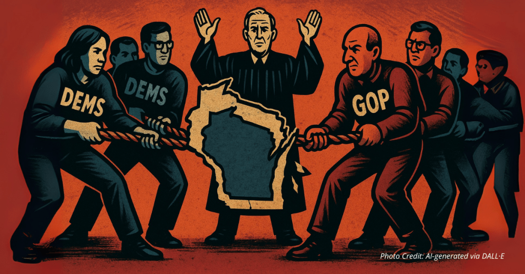
WASHINGTON – The Wisconsin Supreme Court on June 25 rejected a request to reconsider the state’s congressional maps ahead of next year’s midterm elections, all but ensuring the current maps will remain in place for 2026.
The liberal-controlled court’s decision, which was made without comment from the justices, marked the second time in the past two years that the court has rejected a push from Democrats to change the battleground state’s federal maps. It is a loss for Democrats who sought more favorable lines as they aim to retake control of the House in 2026.
Democratic groups filed their latest petitions in May asking the court to reconsider the congressional map lines. Any change would have likely made two of the state’s six Republican-held House seats more competitive for Democrats. Republicans hold six of the state’s eight House seats.
Democrats in their challenge argued the current map was drawn based on a “least change” principle that they said the court abandoned when it struck down the state’s legislative maps in December 2023. That theory refers to favoring maps that minimize changes to existing boundary lines.
Elias Law Group, a Democratic law firm led by Marc Elias, who has led previous voting access lawsuits in Wisconsin and across the country, filed a similar petition last year asking the court to reconsider the U.S. House boundaries, though the court similarly rejected that last-minute push.
This year’s challenge came in the form of two petitions to the high court, which is controlled by a 4-3 liberal majority. Elias Law Group filed one petition, and the Campaign Legal Center filed another on behalf of voters.
The state’s current congressional lines were drawn by Democratic Gov. Tony Evers. The state Supreme Court approved his set of maps in 2022 because it made the fewest changes compared to ones submitted by Republicans and others.
The U.S. Supreme Court in March 2022 rejected the state’s legislative maps, also drawn by Evers, but declined to block the congressional lines at the time.