
By RMV Staff
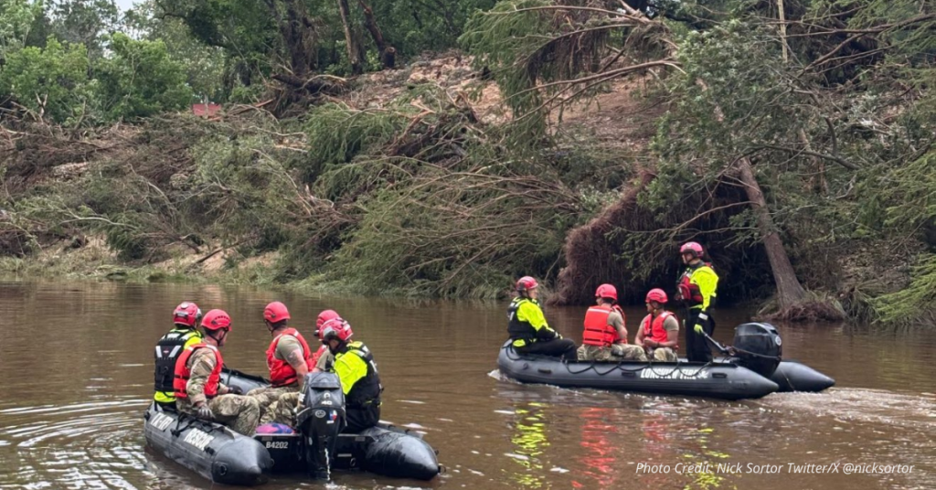
At least 82 people lost their lives in Kerrville when floodwaters tore through the area in the middle of the night. Families had no warning. Rain poured harder and faster than forecasted. In Kerrville, the flood was already doing damage before most people knew it was coming.
Surging rapidly in the darkness, the Guadalupe River caught sleeping Texans off guard.
A Western Colorado weather aficionado contacted RMV following the tragedy to urge more people to take advantage of advanced mobile tools. “As a weather enthusiast with 55 years of experience, I’ve seen major advances in the past decade, including apps that let you track storm signatures and receive early warning alerts,” he said. “Radar Omega puts that in the palm of your hands.”
He described receiving an Emergency Broadcast System-style alert seven minutes before a violent hailstorm. He got the alert just in time to move his car and get inside.
“Seven minutes doesn’t sound like much,” he said, “but my neighbor’s truck got nailed by hail. A few minutes can be the line between safety and disaster.”
How to stay ahead of the storm
Modern weather apps like Radar Omega now offer more than basic forecasts. It shows wind speed, cloud height, rain levels and shifting air—details local broadcasts often miss.
Storm chasers and weather watchers use it to share real-time alerts that can save lives near creeks and rivers.
But no app replaces having a plan. You still need one—know your terrain, stock basic supplies and stay alert.
Some families assign a “watchman” to keep watch when storms are expected overnight. As for gear—stick to the basics: flashlights, water, food, first aid and a backup radio or flares if the signal drops.
Technology, streamers and weather influencers
YouTube storm streamers like Max Velocity and Ryan Hall have changed how people follow severe weather. Their live coverage during tornadoes and floods draws millions—and they use tools like Radar Omega to pair radar scans with reports from the field.
Their streams offer detailed analysis and warnings that reach viewers faster than traditional media. In high-risk areas, their insights have helped thousands take shelter or reroute travel.
Ryan Hall is especially known for tracking tornadic activity live and walking viewers through each development using accessible language.
Max Velocity relies on Radar Omega to deliver real-time updates, and is often praised for his calm, focused info-sharing during crisis moments.
The fight over who’s to blame
The Texas flood has reignited debate over federal weather warnings. Some blame recent forecasting gaps on long-term underfunding at the National Weather Service (NWS). But the record tells a more complicated story.
Beginning in 2018, the Trump administration introduced multiple budget lines for radar upgrades, Mesonet expansion, AWIPS hardware refreshes and supercomputing pilots—signaling a rolling plan to modernize NWS tech.
It also launched the first-ever presidential Wireless Emergency Alert test in 2018 and helped roll out cloud-based IPAWS servers and multilingual alert templates.
However, some alert-system improvements later stalled. In 2025, funding for new EAS hardware was paused, and the FCC delayed release of certain multilingual templates, drawing criticism from public safety groups.
Even so, key upgrades—especially to radar and mobile alerts—were set in motion years earlier by FEMA and NOAA. In this case, NWS did issue a flood watch, calling for up to 7 inches of rain. But some spots got nearly twice that, overwhelming systems not built for that kind of speed.
Final reminder: preparation saves lives
Out West, storms are hitting faster and getting harder to predict. That’s why experts say it’s smart to be ready: get a solid weather app like Radar Omega, follow reliable streamers, have a night plan and keep the basics on hand.
Whether you live near the Guadalupe or the Gunnison, storms don’t wait—and neither should we.